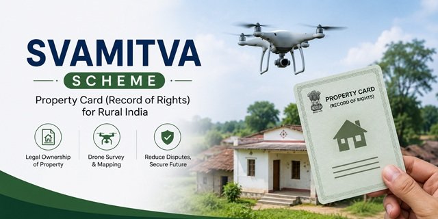
SVAMITVA Scheme is a Central Government initiative that provides rural property owners with a Property Card (Record of Rights) for their residential property in village Abadi (inhabited) areas. The scheme uses drone technology to survey village lands, helping property owners establish ownership records, access institutional credit, reduce property disputes, and store their Property Card digitally through DigiLocker. Residents can check the survey progress and other official updates on the SVAMITVA portal.
SVAMITVA Scheme Highlights | |
| Scheme Name | SVAMITVA (Survey of Villages and Abadi Mapping with Improvised Technology in Village Areas) |
| Implemented By | Ministry of Panchayati Raj, Government of India |
| Technical Partner | Survey of India |
| Launch | Pilot launched on 24 April 2020 and implemented nationwide from 24 April 2021 |
| Beneficiaries | Rural property owners in village Abadi (inhabited) areas |
| Major Benefit | Property Card (Record of Rights) for residential properties |
| Survey Method | Drone-based mapping of village Abadi areas |
| Application Mode | No direct application; survey is conducted by the Government in selected villages |
| Digital Access | DigiLocker and other state-prescribed platforms, where applicable |
| Official Website | https://svamitva.nic.in |
Introduction of SVAMITVA Scheme: A Brief Insight
The SVAMITVA Scheme is a Central Government initiative that provides rural property owners with a Property Card (Record of Rights) for residential properties located in village Abadi (inhabited) areas. The scheme, whose full form is Survey of Villages and Abadi Mapping with Improvised Technology in Village Areas, uses modern drone technology to prepare accurate property records and strengthen rural land governance.
Prime Minister Narendra Modi launched the pilot phase of the scheme on 24 April 2020, coinciding with National Panchayati Raj Day. After successful implementation in selected states, the scheme was extended across the country from 24 April 2021 to facilitate drone-based surveys in eligible villages.
The Ministry of Panchayati Raj, Government of India implements the scheme in collaboration with the Survey of India, State Panchayati Raj Departments, and State Revenue Departments. Its primary objective is to provide eligible rural property owners with an officially recognised Record of Rights, helping improve property ownership records, reduce disputes, and strengthen rural governance.
Under the scheme, the Survey of India conducts drone surveys using modern mapping technology, including the Continuous Operating Reference Stations (CORS) network, to prepare accurate maps of village Abadi areas. After field verification and resolution of objections, the concerned State Government issues the final Property Card. Depending on the state, this document may be known as Gharouni (Uttar Pradesh), Sanad or Akaard 11 (Madhya Pradesh), Gharabara Sanad (Karnataka), or Property Card (Maharashtra). Beneficiaries can also access the document digitally through DigiLocker, wherever integrated by the concerned authorities.
The scheme covers residential properties situated in notified village Abadi areas. It does not apply to agricultural land. Property owners or occupants of eligible residential properties become part of the survey process when their village is notified under the scheme.
Individuals are not required to submit a separate application to receive the Property Card. Instead, the Government identifies eligible villages, conducts the drone survey, publishes draft maps for public objections, completes field verification, and issues the final Property Card after resolving all valid claims.
For assistance regarding the survey process, Property Card issuance, or other scheme-related matters, beneficiaries may contact the Ministry of Panchayati Raj or the concerned State authorities through the official contact details provided in this article.
Rural households may also find the Pradhan Mantri Awas Yojana Gramin (PMAY-G) useful, as it provides financial assistance for constructing pucca houses in rural areas. Urban residents looking for housing assistance can instead explore the Pradhan Mantri Awas Yojana (Urban).
You can also browse our collection of List of Welfare Schemes of Central Government to explore more rural development, land governance, and welfare initiatives.
Benefits Provided to Eligible Beneficiaries
The SVAMITVA Scheme helps rural property owners obtain an officially recognised Property Card (Record of Rights) for residential properties located in village Abadi areas. The scheme uses modern drone-based surveys to improve property records and offers several long-term benefits to eligible beneficiaries.
- Official Property Card (Record of Rights), known by different names across states, such as Gharouni in Uttar Pradesh, Sanad or Akaard 11 in Madhya Pradesh, Gharabara Sanad in Karnataka, and Property Card or Malkat Patra in Maharashtra.
- May facilitate access to institutional bank loans and other financial services by enabling property owners to use their Property Card as collateral, subject to the lending institution’s policies.
- Helps reduce property ownership disputes and boundary-related conflicts through accurate drone-based mapping and verification.
- Supports better Gram Panchayat Development Plans (GPDPs) by providing reliable property and spatial data for local infrastructure planning.
- Improves property tax assessment and collection by Gram Panchayats, helping strengthen local governance and public service delivery.
- Enables beneficiaries to access their Property Card digitally through DigiLocker, wherever integrated by the concerned authorities, in addition to the physical copy.
- Uses modern drone surveying technology supported by the Continuous Operating Reference Stations (CORS) network established by the Survey of India for accurate mapping of village Abadi areas.
Eligibility Conditions Required to be Fulfilled
The SVAMITVA Scheme covers eligible residential properties located in the Abadi (inhabited) areas of villages selected for the drone survey. Property owners or occupants should ensure that they satisfy the following conditions before the Property Card is issued.
- The beneficiary should own or occupy a residential property situated in the Abadi (inhabited) area of a rural village.
- The village should be selected and notified for the SVAMITVA drone survey by the concerned State Government.
- The property should be a residential house or residential plot located within the notified Abadi area. Agricultural land is not covered under the scheme.
- The beneficiary should be able to establish ownership or lawful possession of the property through available records, supporting documents, or verification carried out during the ground verification and public objection process.
Documents Required to be Attached
The SVAMITVA Scheme does not require villagers to submit a separate application form, as the drone survey is conducted by the Government in selected villages. The Ministry of Panchayati Raj has also not prescribed a uniform document checklist for all states. However, during the survey, ground verification, or objection process, property owners may be required to produce the following documents, wherever applicable.
- Any available proof of ownership or lawful possession of the residential property, such as an old revenue record, house tax receipt, or other locally accepted record.
- Aadhaar Card or any other valid identity proof of the property owner or occupant.
- Address proof showing residence in the concerned village, wherever required.
- Sale deed, gift deed, inheritance document, partition deed, or any other ownership-related document, if available.
- Existing property records, patta, Property Card, or other land or house records issued by the concerned authority, wherever applicable.
- Any additional documents or declarations required by the concerned State Government or local authorities during verification.
How Beneficiaries Can Avail the Benefit of this Scheme
The SVAMITVA Scheme does not require villagers to submit an online or offline application. Instead, the concerned authorities carry out a structured survey process in notified villages, allowing eligible property owners to verify their property details before the final Property Card (Record of Rights) is issued.
Step 1: The concerned State Government, Revenue Department, and Gram Panchayat notify the selected village about the upcoming SVAMITVA survey. Before the drone survey begins, property boundaries within the village Abadi area are identified and marked wherever required to facilitate accurate mapping.
Step 2: The Survey of India conducts a drone survey of the notified village using modern mapping technology supported by the Continuous Operating Reference Stations (CORS) network to prepare accurate maps of the Abadi area.
Step 3: Based on the drone imagery, detailed property maps are prepared. These maps are then verified on the ground by the concerned Revenue Department and local authorities to confirm property boundaries and ownership details.
Step 4: After verification, draft property maps are published for public review. Property owners can examine the details and submit objections or correction requests within the period prescribed by the concerned State Government.
Step 5: Once all valid objections are resolved, the concerned authority issues the final Property Card (Record of Rights). Beneficiaries may receive a physical copy and, wherever integrated by the concerned authorities, can also access the document digitally through DigiLocker or the respective State Government’s land records portal.
Note: The survey process, objection period, Property Card distribution, and digital access may vary from one state to another. Beneficiaries should follow the instructions issued by their concerned State Government and Gram Panchayat.
Villagers can visit the official SVAMITVA portal for scheme-related information and updates. State-specific land records portals may also provide additional services relating to Property Cards, wherever available.
Technology Behind SVAMITVA: Drone Survey and CORS Network
The SVAMITVA Scheme uses modern geospatial technology to prepare accurate maps of village Abadi areas. Instead of relying solely on conventional land surveys, the scheme combines drone-based mapping with advanced positioning systems to improve the accuracy and efficiency of property surveys.
- The Survey of India has established a nationwide network of Continuous Operating Reference Stations (CORS) to support accurate geospatial positioning during drone surveys.
- Survey-grade drones capture high-resolution aerial images of the notified village Abadi areas for mapping residential properties.
- The captured images are processed into Ortho-Rectified Images (ORI), which serve as the base for preparing detailed property maps.
- The combination of drone imagery, CORS-supported positioning, and field verification helps prepare reliable property maps for issuing Property Cards under the SVAMITVA Scheme.
Note: The technology used under the SVAMITVA Scheme is intended to improve the accuracy, transparency, and efficiency of rural property surveys. Final Property Cards are issued only after completion of verification and the objection process prescribed by the concerned State Government.
Important Links Available
The following official websites and documents provide authentic information about the SVAMITVA Scheme, including scheme guidelines, survey updates, digital Property Cards, and other related services.
| Particular | Link |
|---|---|
| Official SVAMITVA Portal | https://svamitva.nic.in |
| SVAMITVA Page – Ministry of Panchayati Raj | https://panchayat.gov.in/en/svamitva/ |
| Official SVAMITVA Guidelines (PDF) | View Guidelines |
| SVAMITVA on myScheme Portal | https://www.myscheme.gov.in/schemes/pmsy |
| DigiLocker | https://www.digilocker.gov.in |
Note: Applicants and beneficiaries should rely only on official Government websites for the latest scheme guidelines, survey information, Property Card updates, and other announcements.
Contact Details in Case of Help Needed
If you have any questions regarding the SVAMITVA Scheme, drone survey, Property Card issuance, or related matters, you may contact the Ministry of Panchayati Raj using the details below.
- Office: Ministry of Panchayati Raj, 11th Floor, Jeevan Prakash Building, 25 K.G. Marg, New Delhi – 110001.
- Joint Secretary / Web Information Manager: Ms. Mukta Shekhar
- Email: js2-mopr@gov.in
- NIC Cell Email: >nic-mopr@nic.in
- Official Website: https://panchayat.gov.in
Note: Since the SVAMITVA Scheme is implemented in coordination with the concerned State Governments, beneficiaries may also contact their respective State Panchayati Raj Department, Revenue Department, or Gram Panchayat for survey schedules, Property Card distribution, and other local assistance.
Frequently Asked Questions (FAQs)
Q. What is the SVAMITVA Scheme?
Ans. The SVAMITVA Scheme (Survey of Villages and Abadi Mapping with Improvised Technology in Village Areas) is a Central Government initiative that uses drone technology to survey village Abadi areas and issue a Property Card (Record of Rights) to eligible rural property owners.
Q. Who launched the SVAMITVA Scheme?
Ans. Prime Minister Narendra Modi launched the pilot phase of the SVAMITVA Scheme on National Panchayati Raj Day, 24 April 2020. The scheme was subsequently implemented across the country from 24 April 2021.
Q. Which Ministry implements the SVAMITVA Scheme?
Ans. The Ministry of Panchayati Raj, Government of India, implements the scheme in collaboration with the Survey of India, State Panchayati Raj Departments, and State Revenue Departments.
Q. Who is eligible to receive a Property Card under the SVAMITVA Scheme?
Ans. Property owners or occupants of eligible residential properties located in the Abadi (inhabited) areas of villages notified under the scheme may receive a Property Card after completion of the survey, verification, and objection process.
Q. Does the SVAMITVA Scheme cover agricultural land?
Ans. No. The scheme covers only residential properties situated in notified village Abadi areas. Agricultural land is not included.
Q. What is a Property Card under the SVAMITVA Scheme?
Ans. A Property Card (Record of Rights) is an officially issued document for eligible residential properties surveyed under the scheme. It is known by different names in different states, such as Gharouni, Sanad, Akaard 11, Gharabara Sanad, and Property Card.
Q. How is the survey conducted under the SVAMITVA Scheme?
Ans. The Survey of India conducts drone-based surveys supported by the Continuous Operating Reference Stations (CORS) network. The prepared maps are verified on the ground before the final Property Card is issued.
Q. Can property owners raise objections during the survey process?
Ans. Yes. After the draft property maps are published, property owners can submit objections or correction requests within the period prescribed by the concerned State Government.
Q. How can beneficiaries access their Property Card?
Ans. Beneficiaries may receive a physical Property Card and, wherever available, can also access it digitally through DigiLocker or the respective State Government’s land records portal.
Q. What are the major benefits of the SVAMITVA Scheme?
Ans. The scheme helps improve property records, reduce ownership disputes, may facilitate access to institutional credit, supports better Gram Panchayat Development Plans, and strengthens local governance.
Q. Is an individual application required under the SVAMITVA Scheme?
Ans. No. The Government identifies eligible villages and conducts the survey. Property owners are included in the process when their village is notified under the scheme.
Q. Where can I get official information or assistance regarding the SVAMITVA Scheme?
Ans. Beneficiaries can visit the official SVAMITVA portal or contact the Ministry of Panchayati Raj and the concerned State Government authorities using the contact details provided in this article.

Tabassum is a government schemes researcher and writer with 5 years of experience tracking Central and State welfare scheme programmes across India. She has covered 500+ schemes spanning agriculture, women welfare, education, and housing, helping lakhs of beneficiaries understand their entitlements in simple language.